File:TAoL Hyrule Map 2.png
Jump to navigation
Jump to search

No higher resolution available.
TAoL_Hyrule_Map_2.png (631 × 321 pixels, file size: 136 KB, MIME type: image/png)
Summary
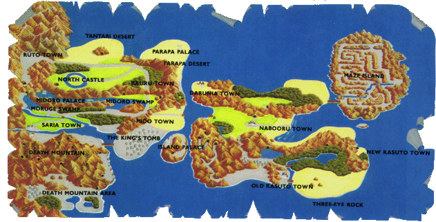
| Summary | Hyrule |
|---|---|
| Type | Map |
| Source | NES Game Atlas Nintendo Player's Guide, Nintendo of America, [which page?] |
| Game | |
| Licensing | 
|
File history
Click on a date/time to view the file as it appeared at that time.
| Date/Time | Thumbnail | Dimensions | User | Comment | |
|---|---|---|---|---|---|
| current | 17:53, 4 January 2018 | | 631 × 321 (136 KB) | MannedTooth (talk | contribs) | Hyrule |
You cannot overwrite this file.
File usage
The following 27 pages use this file:
- Darunia Town
- Death Mountain
- Gallery:Hyrule
- Hyrule/Appearances by Game
- Island Palace
- Kasuto
- King's Tomb
- Locations in The Adventure of Link
- Map of Hyrule
- Maze Island
- Mido Town
- Midoro Palace
- Midoro Swamp
- Moruge Swamp
- Nabooru Town
- North Castle
- Old Kasuto
- Parapa Desert
- Parapa Palace
- Rauru Town
- Ruto Town
- Saria Town
- Tantari Desert
- Three-Eye Rock
- Talk:Lake Hylia
- File:TAoL Hyrule Map 2.png
- Template:AoLNavMap